Monitoring Household Connectivity to the National Grids through Geospatial Technology: World Bank’s Electricity Access Tracking Tool
ANTONY OCHIENG
Clean Leap
The World Bank has entered into a tripartite arrangement together with the Energy Sector Management Assistance Program (ESMAP) and the Sweden-based KTH Royal Institute of Technology, to launch an electricity access tool dubbed Electrification Pathways application and which countries can use to track and monitor households which have not yet been connected to their respective national grids. The tool, which has been rolled out with three focus African countries: Nigeria, Tanzania and Zambia at the moment, and which shall in the near future be adapted to more countries, considers a variety of open, geospatial data to determine the least-cost options for bringing electricity to areas as granular as 1 square kilometer in size. This comes against the backdrop of the recent Kenyan government‟s pre-electoral debate on how many households have been connected to the national grid under the World Bank-funded Last Mile Connectivity Programme. “We have a global population of 1.06 billion people who have not been connected to the grid, and we know that this will change in the future and the only questions are how, how fast, and at what cost," said Dimitris Mentis, a lead researcher with KTH's Energy Systems Analysis division and the developer of the tool. Mentis observed that the tool can help countries fast-track their connectivity efforts, help in optimizing connectivity and help them make more cost-effective decisions, when it comes to ensuring access to sustainable energy for all.

The Electricity Access Tool
This is a welcome move by World Bank, as it is noted that governments and other players handling energy logistics are already relying on proprietary geographic information system (GIS)-based tools to inform their processes and investments in the field. A case in point is Zambia, which has employed it to design a plan for expanding national electricity access. A senior energy specialist at the World Bank, Rahul Kitchlu, observed that tools that offer such high-level of analysis have traditionally been proprietary and therefore costly when leased on the SaaS basis. The Electrification Pathways application is open source, designed in such a way that others can easily adapt the code and datasets for their needs.” The tool also has a powerful backend which also pulls from open data sources to inform its analysis, helping planners to save time on resource-intensive data-collection and allowing policy makers to get key answers faster.
How The Application Works
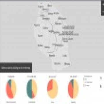
The tool's new powerful analytics derives from the best available datasets, including native World Bank datasets, on population density, distance from existing and planned transmission infrastructural resources, proximity to any road network(s), night-time light, as well as availability of energy resources, among others. For each 1 km square location radius, a comparison of seven electrification technologies is executed, which includes grid, renewable and hybrid mini-grids and individual systems. Based on the acquired geographic data, plus the level and quality of electricity supply sought, the lowest-cost system is selected, and results are relayed for each 1-by-1 km span, while summaries including universal electrification costs are provided in national, state and district level. The World Bank noted that the tool‟s algorithm incorporates ESMAP's Multi-tier Framework, which is an approach to defining, monitoring, and evaluating energy access. The tool is live and can be accessed at https://energydata.info/ and clicking on the "Apps‟ tab which opens into a selection of tools.
What The Innovation Portends For Renewable Energy Players
Mapping main grid installations is a welcome move for many a player in the renewable energy space. This is owing to the need to geospatially map out any geographical gaps where there are unmet energy demands. Banks and other micro-finance institutions could use the tool as a way to assess where the solar energy market is growing or has growth prospects and appropriately finance any such projects to that end. The tool would in the long run be deployed to inform connectivity for such projects as the Kenya Last Mile Connectivity by the World Bank, for instance. Through a mapping of all households connected to the grid, the tool can also be leveraged in resource optimization by companies with interests in the solar energy space, as a way of routing their solar energy inventory to spaces where there is low connectivity. A good example of geospatial mapping of solar energy connectivity in households is exemplified by the Australian PV Institute‟s mapping tool whose background information can be accessed here:
http://www.smh.com.au/environment/solar-mapping-tools-show-realtime-feeds-of-solar-uptake-in-australia-20150428-1mvdgg.html