8 ways Big Data helps improve global water and food security
Christopher Neale
GreenBiz Group Inc.
Big Data is transforming agriculture, and just in time. The demand for food is expected to double by 2050 as the world's population heads toward 9 billion people and increasing incomes allow many more to afford a better diet. Lack of water is a critical constraint to increasing food production, particularly as droughts and other consequences of climate change are making water scarcer.
To help solve this enormous challenge, the agriculture and water communities are harnessing Big Data to ramp up food production with less pressure on our water resources. Experts from around the world gathered in Seattle this week at the Water for Food Global Conference to discuss ways to harness this data revolution in agriculture. Hosted by the Robert B. Daugherty Water for Food Institute at the University of Nebraska in association with the Bill & Melinda Gates Foundation, the conference focused on mobilizing Big Data to improve global water and food security.
With that in mind, here are eight ways Big Data is helping to create a more water- and food-secure world.
1. Satellite imagery and data
Satellites gather vast amounts of data that are used at global and local scales. For example, satellites can track atmospheric patterns, precipitation and ocean currents. Combined with weather data, researchers are using satellite data to develop better forecasting and risk-management tools to help farmers, whether in Nebraska or Ethiopia, make better decisions, and to help governments better plan for droughts and floods. Satellite data also can be used to home in on local areas to precisely map landscapes, analyze soils or assess crop yields, among many other uses.
2. Groundwater monitoring
Globally, agriculture consumes 70 percent of all freshwater withdrawals, primarily for irrigation, and groundwater is a key source of irrigation water. Data regarding aquifer conditions, groundwater withdrawals and other metrics are critical for water managers to prevent catastrophic aquifer depletions. Although water metering to potentially regulate use is unpopular — most recently in California as the state undertakes new groundwater management rules — it's been successfully used in areas of Nebraska for more than 40 years to help maintain groundwater levels, despite having the most irrigated acres in the nation.
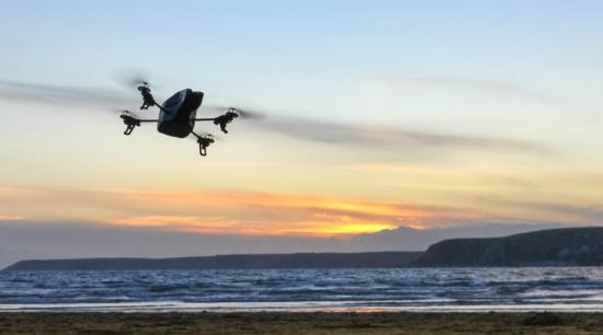
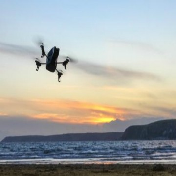
3. Viewing advantages
These days, most people are familiar with the potential of drones outside the military. In agriculture, drones will help farmers, water managers and researchers peer into places otherwise difficult to see. They capture images of entire fields and can zoom into individual leaves to determine the plant's condition. Researchers are developing drones to go beyond capturing images to actually interact with the environment, taking leaf samples, gathering water samples, measuring crop height or applying herbicides to individual plants.
Cameras — and the ability to process huge data files — are giving us new perspectives on our world. In one example, the Platte Basin Timelapse Project from the University of Nebraska-Lincoln placed more than 40 cameras along the entire length of the Platte River watershed, from the headwaters in the Colorado Rockies through Nebraska to the Missouri River. The cameras take a picture every daylight hour. The visual timeline gives scientists, resource managers and the public a greater understanding of the influences agriculture, municipal water supplies, geological processes, restoration projects and other activities have on the watershed, leading to better watershed management.
4. Precision agriculture
Precision agriculture defies the stereotype of farmers as low-tech traditionalists. Today, a host of technology from GPS-equipped tractors to remote-controlled or even automated irrigation systems is turning farming into a high-tech business.
Water sensors placed throughout a field monitor soil moisture in real-time, which help a farmer decide when and how much to irrigate. Fed to computer-controlled irrigation systems, that information allows precise water applications rather than a single amount across an entire field.
In another example, computer-equipped combines gather data during harvest to create detailed yield maps, which are used to create a precise prescription of fertilizers and other inputs to improve productivity the following year. Such advances translate into higher yields using less water and energy. And, thankfully, the high-tech nature of agriculture is also attracting young people back to farming.
5. Global atlases
Where in the world do we have existing farmland with the capacity to produce much higher, stable yields? Which river basins are running dry, and why? Researchers are gathering and analyzing satellite, atmospheric, on-the-ground and historic data to create mapping tools and models that help governments and others improve agriculture and conserve water.
For example, the Global Yield Gap and Water Productivity Atlas, a global collaboration led by the Water for Food Institute, identifies existing farmland worldwide where significant gaps exist between actual and potential yields for different crops. The atlas estimates global yield trends and food security for global analyses and, perhaps more important, helps individual countries identify production potential to improve policy and to better strategize resource allocations and trade opportunities.

6. Regional mapping
Countries are taking on their own Big Data projects to better plan for the future. Sri Lanka, for example, recently began mapping many of its primary river basins and modeling climate risks to develop a comprehensive flood and drought mitigation plan. In the Dominican Republic, I participated in a project that created a spatial database of the country's entire irrigated properties. The data allows water managers to better maintain the country's extensive irrigation canal systems, conserve water and create equity among water users.
7. Smartphones
Big Data analysis and modeling can reach even subsistence farmers in remote areas. Many farmers in poor, rural areas in sub-Saharan Africa and elsewhere, long isolated by insufficient phone service and roads, have cellphones. They now have access to weather forecasting and market information to make better decisions, manage money and develop a wider support network, thereby improving livelihoods as well as local water and food security.
8. Research advances
Science is driven by data. Greater data gathering and computing power is allowing researchers to develop drought-resistant crop breeds, better understand climate change and create models that help us understand risks and opportunities moving forward, among other research goals.
Much data is flowing in agriculture, creating numerous opportunities to increase food production without compromising limited water resources. But many challenges remain to ensure the data flows efficiently and to those who need it most.